Portfolio solutions and projects

<< GO BACK  

 VHR_ UACD: Very High Resolution Change Detection in Urban Areas

Provides:

  • Identification of new built-up areas with a pixel resolution of 5m within the urban fabric
  • Identification of illegal building in post-fire situations
  • Direct or indirect monitoring of SDG Indicator 11.3.1: Ratio of land consumption rate to population growth rate
  • Calculation of urban indicators, e.g. yearly per capita soil consumption

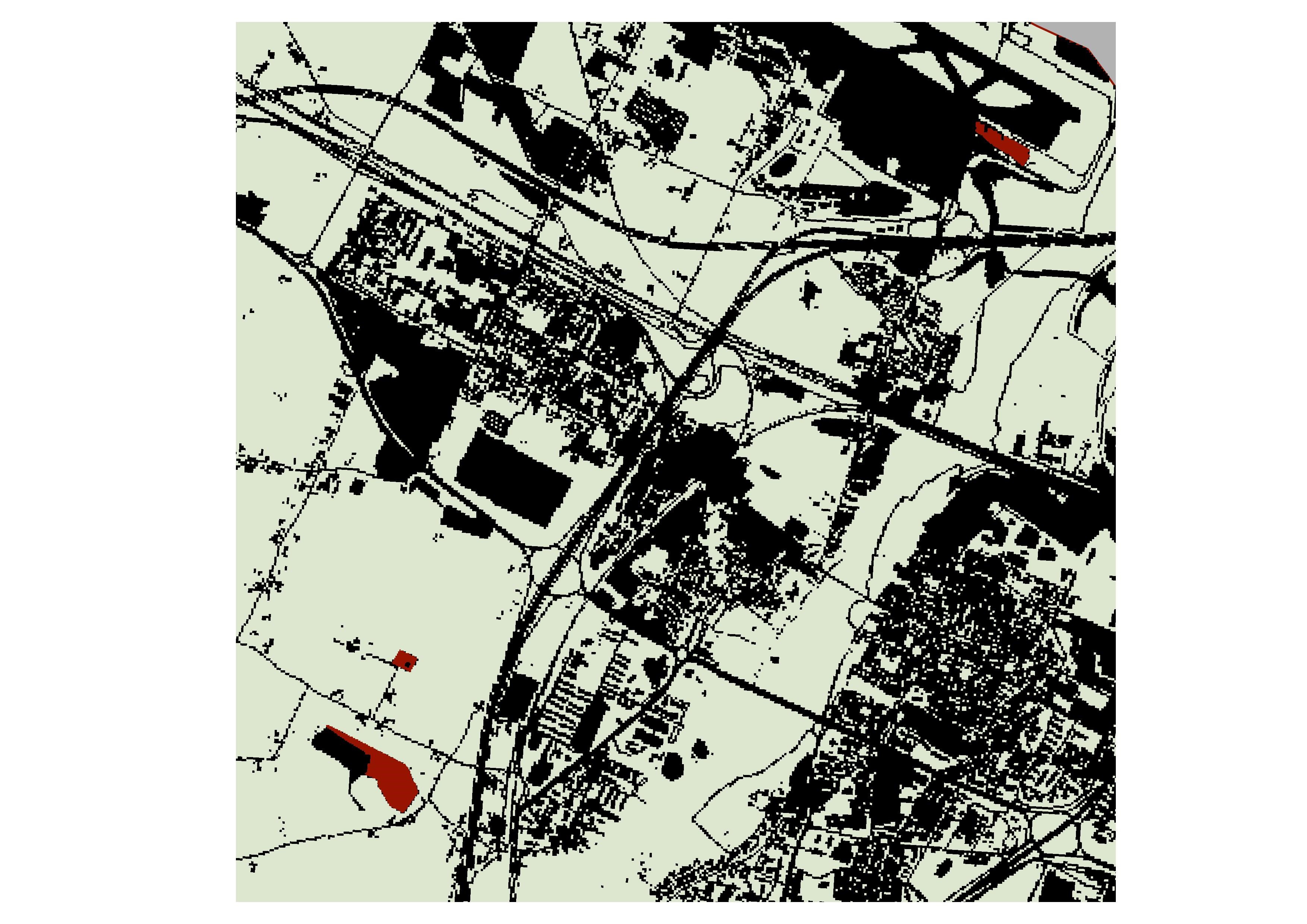
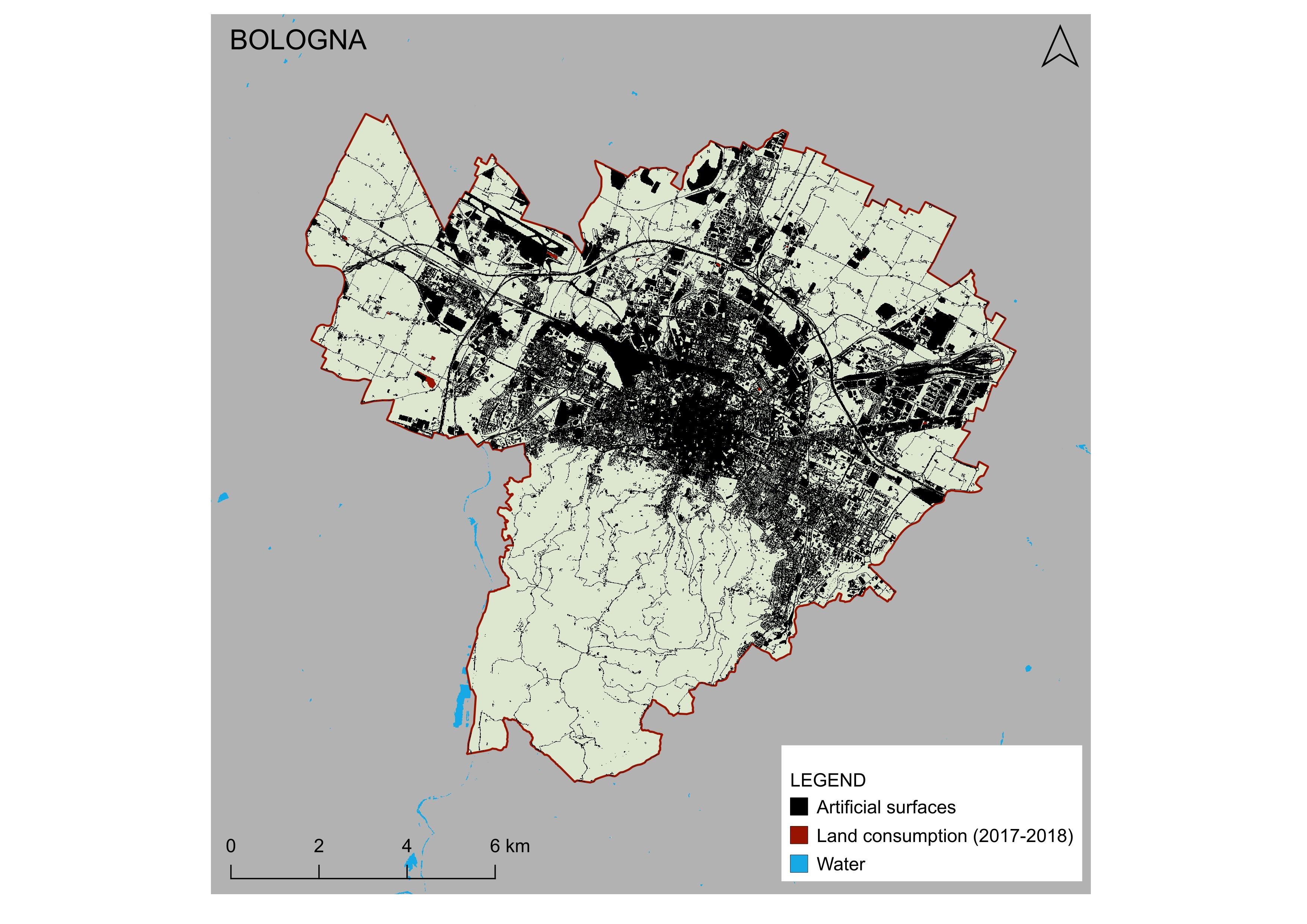
The changes at 5 meters as an example for one of the 5 pilot cities: Bologna

Makes use of: Satellite and aerial imagery, Sentinel-1 and Sentinel-2 data products.


Smart features:

  • Solution is based on very high-resolution data that is beyond the usual modus operandi in current city authorities’ approach
  • User friendly GIS frontend for stakeholders provided via web-portal


Read more: https://www.isprambiente.gov.it/it/evidenza/snpa/no-homepage/consumo-di-suolo-dinamiche-territoriali-e-servizi-ecosistemici.-edizione-2019

Developers:    

Contact Information: Astrid Raudner ([email protected]), Michele Munafo ([email protected])

SMURBS cities: Trieste, Venezia, Bologna, Napoli, Monopoli (Italy)


Involved Partner(s): ISPRA (IT)
EO Platform(s) utilized:  Satellites
Theme: theme-icon Urban Growth