 Urbem: A GIS – based tool in service of high resolution air quality mapping
|
Provides:
|
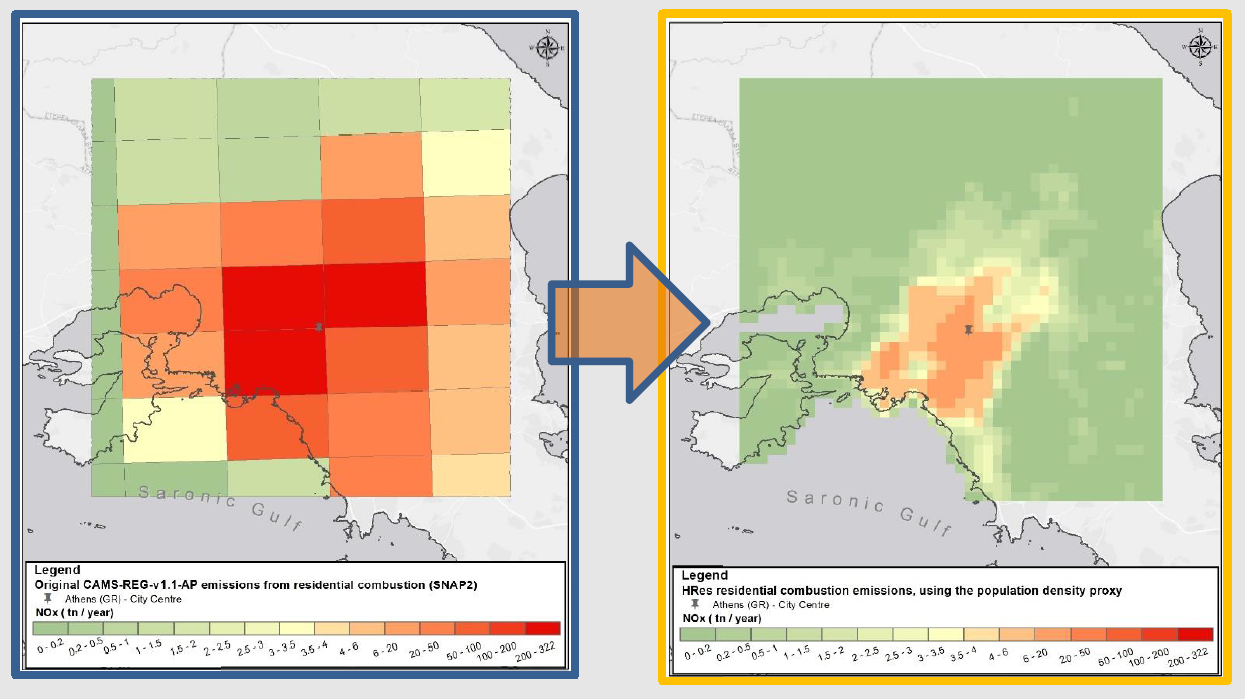
Makes use of: Copernicus (CAMS, CLMS etc.) data, Model
Smart features:
|
Read more: Ramacher M., M. Karl, E. Athanasopolou, A. Kakouri, O. Speyer, and V. Matthias, A novel approach for dynamic population activity in urban-scale exposure estimates, EGU 2020 General Assembly, Online, 4–8 May 2020.
Developers: 
![]()
Contact Information: Martin Ramacher ([email protected]), Nasia Kakouri ([email protected]) , Eleni Athanasopoulou ([email protected])
SMURBS cities: Hamburg (Germany), Athens (Greece)