Portfolio solutions and projects

<< GO BACK  

Urban LC (Classification EAGLE)

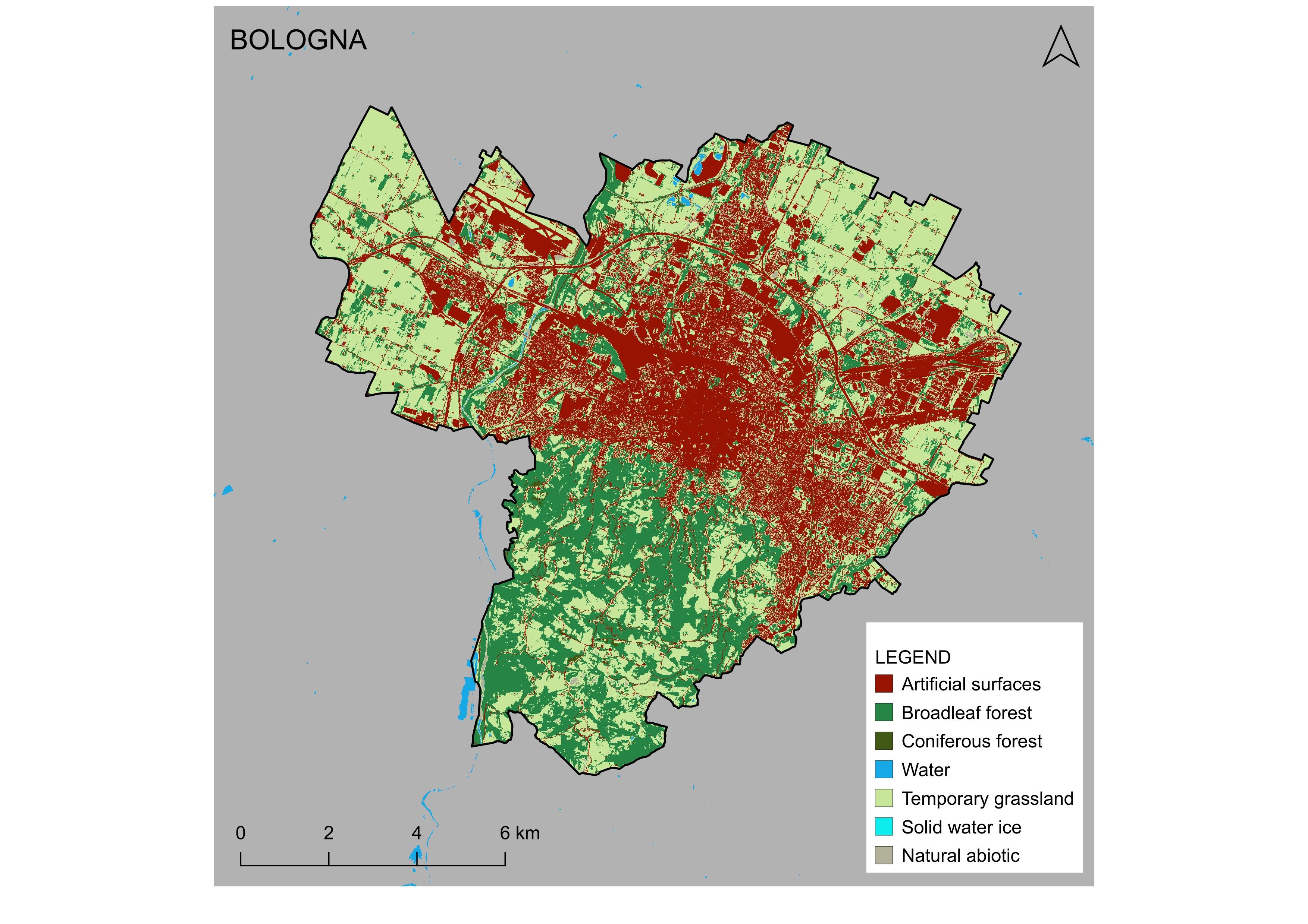
Provides:

A classification system for Landcover based on EAGLE

  • Production of baseline Land Cover maps (10m) for comparisons and future monitoring
  • Potential input data for EODESM system developed in the ECOPOTENTIAL project
  • Elaboration of specific indicators such as fragmentation
  • Monitoring of coastal areas

Example of applying this classification system on one of the five pilot cities: BOLOGNA

Makes use of: Sentinel-1 and Sentinel-2 data products.


Smart features:

  • Application of state-of-the-art LC EIONET EAGLE concept
  • Migrating to satellite processes, enhances time availability, frequency of updates and ensures sustainability (secured by Copernicus) as well as scalability.
  • User friendly GIS frontend for stakeholders provided via web-portal (WMS)


Read more: https://land.copernicus.eu/eagle,

https://land.copernicus.eu/user-corner

Developers:    

Contact Information: Astrid Raudner ([email protected]), Michele Munafo ([email protected])

SMURBS cities: Trieste, Venezia, Bologna, Napoli, Monopoli (Italy)


Involved Partner(s): ISPRA (IT)
EO Platform(s) utilized:  Satellites
Theme: theme-icon Urban Growth